


As I promised in the first piece of my substack series on the old books I have collected, I am in this second one, talking about English writing on India, from the early nineteenth century. The two volumes in this piece are not well known, nor is their author, an armchair scribe whose explorations led him to write an account of India, may I add, not devoid of scholarship.
The British in India studied the country minutely. There were many who felt no empathy for the country. But there were others who saw through the glass with curiosity and with an absorbent frame of mind. Reading some of these accounts today, in the 21st century, illuminates facets and angles that we often take for granted.
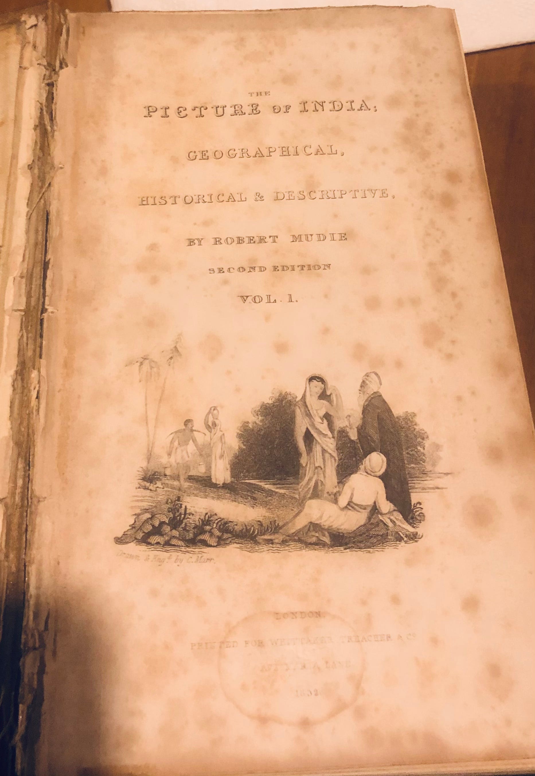
Robert Mudie, the author of “The Picture of India”, which is the subject of our discussion here, to the best of my knowledge never visited India. He was the author of several books on far off countries as he lived out life as a teacher, and a newspaper editor and author in Scotland and then England. Imagine sallying forth to write about a country so different from his own and basing his account like the Irish poet Thomas Moore’s poem “Lalla Rookh” (1817) on travellers’ accounts and published histories, writings of explorations by sundry men of fortune. But that is what Mudie set out to do, and these two volumes are a result of his wandering pilgrim’s progress in a country he never saw or experienced.
THE BANYAN
So let us set out to see what caught Mudie’s exploratory mind-set. He is writing in 1830, and the two volumes on “The Picture of India” were in a second edition by 1832, which is the set I am looking at. So obviously, their readership was sufficient enough to warrant that second printing. India was the object of his fascination. He compares the hills of England to ‘molehills’ when they are confronted with the lofty Himalaya (‘Our loftiest mountains are but as molehills to its stupendous ridges”). The palms of India are graceful, while the banyan tree, the ficus Indica which “defies the course of ordinary vegetable decay, and puts on the semblance of immortality” has a life that can span a thousand years or more. The banyan has long fascinated the foreigner in India and even those who have not been to this country - those like Milton who included a paean to the tree in “Paradise Lost”, the tree which “spreads her arms” in Malabar and the Deccan, branching broad and long:
“that in the ground,
The bended twigs take root,
And daughters grow
About the mother-tree, a pillar’d shade
High over-arch’s, and echoing walks
between”
THE HINDUS
Mudie , the scribe, is anxious to establish at the outset that he has “no pecuniary interest” in India. He is struck by “the endurance of the population” which he sees as the most interesting aspect of the country. He compares it with other parts of the globe where “the conquered have given place to the conquerors”. But not so in India. The Hindu in his words, is unaltered or diminished by any foreign conquest or intrusion. These are his words: “But the Hindu is the same. Like a flexible reed in the storm of the atmosphere, he bends level with the earth before every wind of conquest, come from whither so ever it may; but he is as elastic as he is flexible, and no sooner has the storm passed, than he is again erect and vigorous. The cause of this permanence in spite of changes, - this unaltered endurance amid conquests, more numerous, perhaps, than those that have visited any other country, is so singular and so much at variance with that which has taken place in other parts of the world, that it is eminently worthy of investigation.” He compares the Hindus with the Jews who remained a separate and unchanged people despite being exposed to the “greatest obloquy and injustice” and remained so despite changes in the states and nations where they were scattered (before the creation of Israel). Both these peoples, in his view, remained unconnected with, and therefore indifferent to the governments which alternately tolerated or oppressed them.
“AN IRREGULAR FOUR-SIDED FIGURE”
Let us turn to how he describes the geography of India. He calls “Continental India” as the “central, largest, and in every sense of the word, most important of the three peninsulas, in which Asia terminates southward”, the three being the Arabian Peninsula , the Indian Peninsula and the Malay Peninsula (which in eighteenth century maps is often erroneously referred to as “India beyond the Ganges” or “India Ultra Gangem”). India in his words, “is an irregular four-sided figure”, directed towards the south-east, north-east, north-west, and south-west with two sides washed by the sea, and two bounded by land. `He goes on to measure the north-to-south length of the country: “The length of the line that can be drawn in India from north to south, is from a point in latitude 35 degrees 30 minutes north, and longitude 73 degrees east, southwards, including to the east, to Cape Comorin , the south most extremity, in latitude 8 degrees 4 minutes north, and longitude 77 degrees 45 minutes east. The length of this line is, in round numbers, about one thousand nine hundred miles.” Is this the legendary traverse of Kashmir to Kanyakumari? Mudie saw India as “beginning at Hindu Cosh (Hindu Kush), a great snowy summit, about seventy miles to the north-west of the city of Cabul, in Afghanistan”. He skimps on the details. Early nineteenth century India was still being mapped. The stupendous Great Trigonometrical Survey began in 1802.
We tend to take the different climatic zones of India for granted. But the geographical differences that Mudie draws attract attention. He observes that the two seas that wash the shores of peninsular India, the Arabian Sea and the Bay of Bengal, are each of different character. The northern shores of the Arabian Sea touch areas that are arid and dry and “sterile” to use his words (he means the deltaic regions of the Indus and westward towards Baluchistan) while the shores of the Bay of Bengal, separated in the south by the Malay Peninsula from the “broad Pacific” which “extends to the shores of America” is a narrower sea, contiguous to areas that have the “most moist and luxurious” vegetation in the world. This makes the east of India very different from that which lies to the north of the Arabian Sea. The Himalayan ridge fencing the areas of India north and north west of the Bay of Bengal confines the humidity that the winds waft from the Indian Ocean, the Arabian Sea and the Bay of Bengal, and “returns it back in those magnificent rivers that water the northern parts of India” so that it is these mountains that have “much influence on the climate and fertility of the whole country”. Not an inaccurate observation even if from one who had never visited India.
THE SITUATION OF INDIA
Mudie calls India “the celebrated region” and that on examining its position on the map, “one cannot help perceiving that, in regard to communication, and consequently commercial intercourse, its situation is most advantageous.” The whole of southern Europe is open to India through the Persian Gulf while the passage around the Malay Peninsula helps communication “with the Oriental Islands, with the whole of east of Asia, including the important countries of China and Japan, with the scattered islands in the Pacific, and with the whole western coast of the American continent.” Looking thus at the situation of India he notes that “we find that it is central among the nations”.
This reference to the central nation is as if, without knowing it, Mudie is recalling the India of traditional Indian maps (see picture) where the island of the wood apple trees, Jambudvipa is the centre of the mortal world, and where India is located.
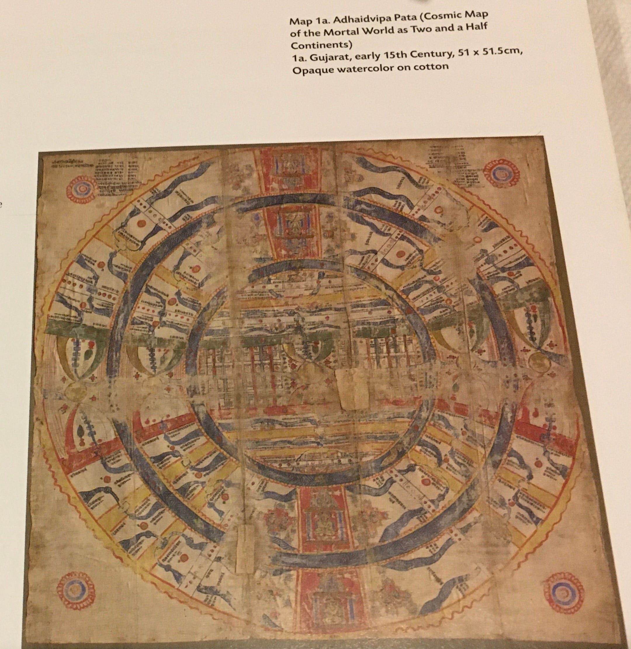
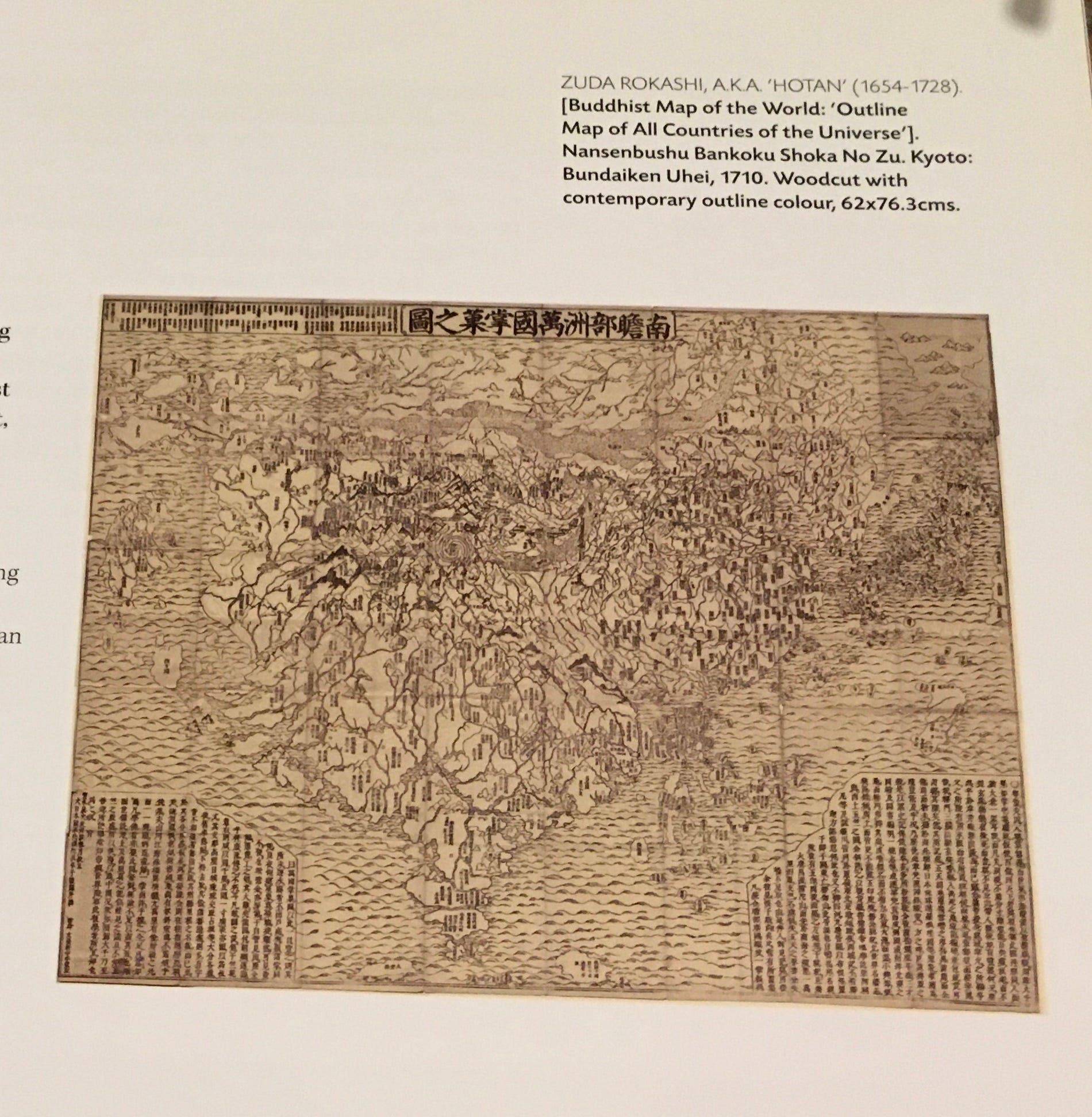
The Chinese title themselves as the Middle Kingdom -Zhongguo- but India, being described as the most central of nations, does have a convincing and persuasive ring to it. Mudie certainly, was a believer. By the way, talking of maps from Asia, by Asians, there is a fascinating 18th century “Buddhist map of the world”, from Japan, an outline map of “All the Countries of the Universe” which centres on India and China as the Buddhist countries, at the expense of Europe, Africa and the Americas, which are described as being “as small as a millet-grain”.1 That, is the world, seen through Asian eyes.
Mudie, ignorant of the commerce transacted by the ancient Indians with Europe, Asia and Africa and only aware of the foreign traders who came to India’s shores to transact trade, says that “India has never yet been a country of adventure”. Many Indians will not agree with him. As one example, one just has to read the epic Tamil story of “Ponniyin Selvam”2 and the exploits of the navy of the Cholas to understand this.3 But interestingly, he compares the peninsula or southern part of India to a region that “partakes more of the nature of an island” being exposed “to the action of no land, save the portion of India to the north”; it follows that this part of India has always oriented itself to the maritime world beyond, as its history proves. Peninsular India is truly, India Ultra Gangem.
In the next in this series, I will share impressions from another set of old volumes, again from the early 1800’s: “Hindoostan in Miniature”. Till then, stay safe and well.
Nanda, Dr. Vivek|Johnson, Dr. Alexander: Cosmology to Cartography A Cultural Journey of Indian Maps, National Museum, New Delhi (no date), p. 57 Both maps reproduced above in this article are from this book.
https://en.wikipedia.org/wiki/Ponniyin_Selvan
https://en.wikipedia.org/Chola_Navy